Lanx
<Prior Amod>
- 77,050
- 181,650
isn't a blackbox supposed to have gps and survive a nuclear blast?

- 1


 www.nature.com

 www.wsj.com
In no way do I look forward to this. I cringe at the idea of having Drones crossing the sky around my house. I do think a lot of drones are going to get mysteriously shot down.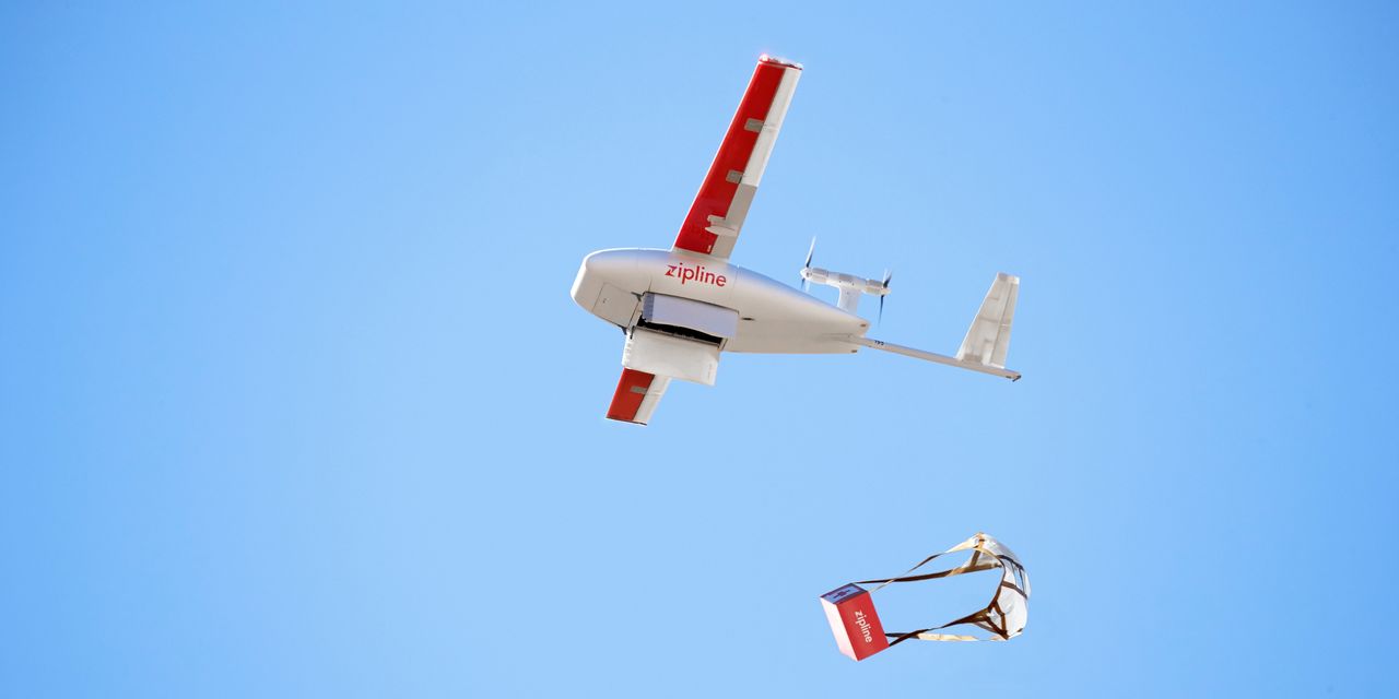
Amazon, Alphabet and Others Are Quietly Rolling Out Drone Delivery Across America
Drone companies have been cleared to expand their operations across the U.S., in cities as well as rural areas, at the same time their tech has become faster and more reliable. Coming by air to a front door near you: 33 chicken wings with sauce and fries; 27 if they’re bone-in.
No it does not include the airspace (currently). Drones can fly over private property, too.Actually, honest question and not 100% talking about delivery, but the topic in general. If you own property and someone is on it, uninvited, it is trespassing. Obviously we dont charge the mailman, but as a concept you own private rights to you land. Does that include airspace and if so to what altitude?
Honest question. I have no plans on shooting down my amazon droid flying in, but it will raise this question legally.

 ouster.com
Actually, honest question and not 100% talking about delivery, but the topic in general. If you own property and someone is on it, uninvited, it is trespassing. Obviously we dont charge the mailman, but as a concept you own private rights to you land. Does that include airspace and if so to what altitude?
Honest question. I have no plans on shooting down my amazon droid flying in, but it will raise this question legally.

Specifically, the Federal Aviation Act provides that: "The United States Government has exclusive sovereignty of airspace of the United States" and "A citizen of the United States has a public right of transit through the navigable airspace."[3] The "navigable airspace" in which the public has a right of transit has been defined as "the airspace at or above the minimum altitudes of flight that includes the airspace needed to ensure safety in the takeoff and landing of aircraft."[4]
The exact altitude(s) at which the airspace over private land can become subject to "substantial impairment" is often debated. Case law in the past has used the height of 500 ft (150 m) in urban or suburban areas,[5] and 360 ft (110 m) above the surface or tallest structure in rural areas[6] as the demarcation of where impairment of property rights can occur.
However, the bulk of more recent decisions, which take precedent, hold that taking can occur regardless of if the flight occurred within navigable airspace or not and only impairment of property need be considered.[7] This is especially important as some aircraft (manned and unmanned) now have no minimum flight altitudes making virtually all airspace "navigable".
That aside, unless you lived in the boonies, discharging a firearm outdoors to shoot anything is going to have its own set of legal ramifications
Air rights - Wikipedia
en.wikipedia.org
Consultant TOR: Geospatial Data Scientist
April 2022
THE WORLD BANK
TERMS OF REFERENCE
PACIFIC OBSERVATORY – GEOSPATIAL DATA SCIENTIST
A. PROJECT BACKGROUND AND OBJECTIVES
Project Background
Many countries in the Pacific region lag international norms in the production and dissemination of core economic statistics, including those on macroeconomic indicators and economic activity, household surveys to measure well-being and socioeconomic characteristics, firm surveys to understand market health and dynamics, and key sector statistics vital to project development. Challenges for the production of statistics generally include limited infrastructure and technical capacity, lack of adequate funding and limited use and re-use of data. Countries specifically in the region additionally are hampered by high staff turn-over, thin technical capacity, and high data collection costs due to vast geographic distances and small populations. In the context of COVID, timely data is more critical than ever to inform policy and programming, and fiscal pressures present further risk to adequately resourced and regular traditional data collection. The Pacific Observatory is the World Bank analytical program to explore and develop new information sources to mitigate the impact of data gaps in official statistics for Papua New Guinea (PNG) and the Pacific Island Countries (PICs). The activity will identify information sources, develop processes and build capacity to provide data and analysis to complement traditional data sources for economic activity, livelihoods and poverty. This will provide robust analytical foundations for WBG operations to address development needs like tailoring adaptive social protection mechanisms for poorest segments of society. The activity will also help to monitor and evaluate WBG operations by enabling quick assessments and response targeting for evidence-based interventions to support communities during natural disasters and other shocks and by improving outcomes for women and girls through gender-disaggregated data and information about the impacts of shocks.
Alternative data sources for sector statistics
As part of an assessment of various sectoral themes where big data assets can complement official statistics, the Pacific Observatory team has selected Automatic Identification System (AIS) as a potential resource to improve statistics on fisheries and trade. License revenues from fishing activities represent a critical component of the economics of the Pacific, particularly for Kiribati, Papua New Guinea, and Solomon Islands. However, estimates of fishing volume or the economic output from these revenues are limited to sporadic assessments. Where available, annual estimates are reported with some delays by the National Statistics Offices (NSOs) or the Pacific Islands Forum Fisheries Agency (FFA). Most manufactured goods in the Pacific countries are imported by sea, making it another important component of GDP. Data on merchandise trade suffers from similar lags, with publication delays of 12 months or more for most Pacific countries. Given these data gaps, this consultancy will assess the feasibility of using AIS data to derive high-frequency and geospatially disaggregated indicators on
Consultant TOR: Geospatial Data Scientist
April 2022
fisheries and trade. This capability is particularly relevant in the context of trying to understand the impacts of natural disasters or the COVID shock on Pacific economies.
AIS Data
The Automatic Identification System was originally developed by the International Maritime Organization in 2004 to prevent collisions between large vessels. This system requires all commercial ships (gross tonnage greater than 300) and passenger ships to broadcast their position and other characteristics via ground stations and satellites. The resulting data is highly complex as it includes dynamic information on ship movements (position and speed), and static information on ship characteristics and voyage-related attributes.
Although AIS was originally developed to maintain safety at sea, recent work by IMF researchers has highlighted its potential to nowcast economic statistics, with a particular focus on trade. Most relevantly, Arslanalp, Koepke and Verschuur (2019) conducted a study to track daily merchandise trade at the port-level in the Pacific Islands. Additionally, the UN Global Working Group on Big Data for Official Statistics created an AIS Task Team which has presented numerous case studies demonstrating the use of AIS data to derive statistics, and yielded a dedicated computing environment to process the data. Other groups have used AIS data to monitor large-scale commercial fishing (Global Fishing Watch) and publish daily estimates of fishing effort in geospatial grid format.
This consultancy will build on these initiatives by testing, adapting, and improving methodologies to create reliable statistics for the Pacific Islands.
B. SCOPE OF WORK
The geospatial data scientist will support the task team by leading this exercise and implementing analyses with AIS data. Specific tasks include:
• Review resources (existing algorithms, methodologies, AIS datasets).
• Apply existing methodologies estimating trade to the Pacific Island countries.
• Develop new methods to produce high-frequency indicators on fishing intensity and trade.
• Document workflows through data science notebooks.
• Compare derived statistics with official sources of data.
• Document findings through a technical note and blog posts.
• Prepare visualizations and maps of AIS data and output statistics.
• Report findings through presentations to the Pacific Observatory team and relevant counterparts abroad.
• Support the Pacific Observatory team on ad-hoc data engineering and analytical tasks.
Consultant TOR: Geospatial Data Scientist
April 2022
C. DELIVERABLES/SPECIFIC OUTPUTS EXPECTED FROM CONSULTANT
The consultant is expected to deliver at the end of the assignment the following outputs:
• Data science notebooks processing AIS data
• Documentation of methods and code through github
• Technical note reporting findings from investigation (data quality assessment, results from analysis, comparison with official statistics)
D. SPECIFIC INPUTS TO BE PRESENTED BY THE CLIENT
World Bank will provide the consultant with various inputs needed for the analytical task:
- Relevant papers on the topic
- Access to raw and processed AIS data
- Access to the United Nations Global Platform (dedicated platform for AIS)
- Computing resources as needed
E. SPECIAL TERMS & CONDITIONS / SPECIFIC CRITERIA
The short-term consultant will be allocated 40 days to work between May 1st 2022 and June 30th 2022. After this evaluation period, an additional 60 days starting on July 1st 2022 will be allocated pending approval.
The consultant is required to have relevant work experience working with big data sources such as AIS, and a programming skillset which includes:
• Python, specifically using Jupyter notebooks (required)
• Experience with high-frequency time series data (required)
• Knowledge of GIS software and geospatial tools (required)
• Experience with parallel computing environments, such as apache spark or dask (preferred)
• Working knowledge of github (preferred)
Processing AIS data requires sophisticated workflows applied to a large dataset (spatial and temporal filtering, imputation of missing information, designing algorithms to subset AIS signals relevant for fishing or trade). The ideal candidate will demonstrate a strong data science expertise with AIS data, or other big data sources that required comparable workflows.
Applications are due by April 29th, 2022. Applicants are encouraged to submit their resume or CV, and links to code samples (preferably through Github links), mapping samples, and other relevant material to [email protected].
Dude thought it'd be a good idea to heckle Mike Tyson on a plane